
Rain Water Harvesting as a Climate Adaptation Option
Drylands cover nearly half of all terrestrial land surfaces, of which 72% are in developing countries and support over a quarter of the global population’s living space. They are the main contributor to global food production and a variety of fruit trees. However, water scarcity in drylands greatly constrains agricultural 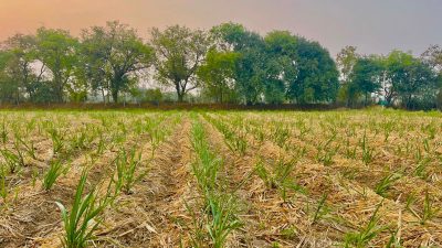 productivity, particularly in undeveloped rural areas where sophisticated irrigation systems are a luxury. Therefore, efficient use of rainwater through rainwater harvesting technologies (RHTs) is an effective avenue to alleviate water stress and improve agricultural productivity, which could contribute to several Sustainable Development Goals such as SDG 2, SDG 6, and SDG 15. Improving rainwater use in agriculture is necessary to ensure sustainable food production for the growing global population. Since the use of water from river and groundwater resources is reaching unsustainable rates, increasing water withdrawals and consumption by intensive irrigation is not a
suitable option in many regions of the world. Moreover, a better management of freshwater resources alone will not be sufficient to ensure sustainable food production, because land degradation caused by climate and land use change drivers is a major constrain to agro-ecosystems’ functions. On the other hand, rainfed agriculture still has a large untapped potential, particularly in dry and tropical developing areas. To tackle this urgent issue, the UN General Assembly recently declared the 2021–2030 as the “Decade on Ecosystem Restoration”, which acknowledges and enforces the restoration of degraded ecosystems as a necessary measure to fight climate change and enhance food security, water supply and biodiversity. To address the sustainability of future agriculture in this context, a more holistic approach aiming at agro-ecological restoration through sustainable land and water management is a fundamental milestone. Rainwater harvesting can represent an important strategy to improve rainfed agriculture and increase crop yield sustainably, especially in marginal areas and improve human wellbeing. Broadly, water harvesting can be defined as the set of practices intended to increase water availability for plants, including water infiltration and retention in the soil, through the collection and storage of rainwater or runoff. Retaining and conserving more rainwater for productive purposes can help coping with prolonged dry spells, the major challenge faced by rainfed agriculture, especially in the most arid and semi-arid areas of the world. Typical examples of rainwater harvesting practices are dugout ponds, used to collect and store rainwater within the farmland for supplementary irrigation during dry periods. Other widespread practices are terraces, built on steep terrains to slow down runoff and increase infiltration and traditionally used in the Latin American, African and Asian highlands.
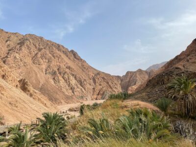
The agrosilvopastoral system is the largest agricultural production system in the NENA region (covering 60 % of the agricultural land), encompassing a diversity of rangelands, including grasslands, shrublands, scrublands, woodlands, savannas and sparsely vegetated deserts. These essential dryland production systems dominate the low rainfall areas (average annual rainfall below 250 mm) and provide vital services for pastoral, agropastoral and silvopastoral communities. Despite their importance and scale, these systems have been largely neglected and are often referred to as marginal and degraded lands. Overexploitation and mismanagement have triggered the decline of vegetation cover and soil health. The bare and crusted soils have limited rainwater retention and infiltration potential, which in turn leads to increased surface runoff and erosion. Developing the area that is suitable for rainwater harvesting can enhance the concentration and facilitate storage of excess rainwater in defined locations for targeted utilization by local communities. Water harvesting has been widely applied in this way to cope with water scarcity and provide supplemental irrigation during dry spells (Shadeed and Lange, 2010; Tabieh et al., 2016; Oweis, 2017; Behera et al, 2020). The vulnerable communities that depend on these lands for their livelihoods need to be supported by reinforced efforts through systematic land use planning informed by robust mapping and spatial quantification approaches especially on the potential to increase water productivity while combatting land degradation in these systems. In this context, the availability of tools that are scalable and easily adoptable by national institutions across the NENA region is vital for success.
Background of the Research Consortium (ICARDA-AOAD-FAO)
In recent years, ICARDA has made substantial progress in advanced digital processing (digital augmentation) and related tools’ development as part of the GeoAgro platform. This platform (http://geoagro.icarda.org/) brings together vast experience and expertise on geospatial modeling and mapping on water harvesting potential in the region. Building on recent advances in machine learning, and cloud computational power using Google Earth Engine tools, ICARDA is now able to assess and map the areas with water harvesting potential in NENA’s agrosilvopastoral systems. This is done by combining remote sensing data in time-series with topography and climate data, as well as extensive onsite observation to support eco-hydrological modeling. The assessment will identify the potential areas for investments in scaling-up of the integrated management approach throughout the NENA Region. This proposed assessment will also integrate landscape level ground validation of the concept and model for water productivity in agrosilvopastoral systems, towards a regional analysis providing the basis for water harvesting potential expansion within sub-agroclimatic regions along with the related investments required. The work will build on and ensure cross-platform collaboration with other initiatives such as FAO’s Hand- in-Hand (HiH) and Regional Knowledge Platform (RKP), and ICARDA’s GeoAgro Platform and DryArc interface. This multi-criteria mapping and analytical assessment will help identity hotspots for acceleration of rangeland restoration and area development activities in low rainfall areas by developing rainwater harvesting suitability maps at the NENA level. The multi-criteria suitability maps and related data will be made available to stakeholders through the development of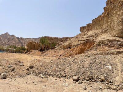 a web-based interface for easy access and valuation of site-specific implementation across the NENA Region. ICARDA and FAO collaborate with the Arab Organization for Agricultural Development (AOAD) to strengthen the regional approach, the dialogue with stakeholders and the dissemination of results. This project contributes to FAO Members’ global goal n. 3 “Sustainable management and utilization of natural resources, including land, water, forest, fisheries and genetic resources for the benefit of present and future generations” and to the Sustainable Development Goal 6, target 6.4 “By 2030, substantially increase water-use efficiency across all sectors and ensure sustainable withdrawals and supply of freshwater to address water scarcity and substantially reduce the number of people suffering from water scarcity”. By addressing SDG 6.4, the project results will serve also as catalyst to the achievement of other goals. Moreover, the project will contribute to the FAO Strategic Objective 2 (Make agriculture forestry and fisheries more productive and sustainable). In this context, ICARDA, AOAD and FAO plans to joinly organize a Regional Training on the Assessment of Water-harvesting Scaling-up Potential for the NENA Region. The focus is to dessiminate a on Web-based Digital Platform to the regional stakeholders to Support their Decision Making on Context-Specific Scaling of Rain Water Harvesting Interventions and Investments.